

Kanchenjunga Circuit Trek 2027
Complete Guide, Itinerary, Permits and Best Time
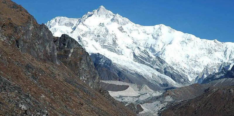
The long walk around the world’s third highest mountain,The Kanchenjunga Circuit Trek is a 21 to 26 day trek in far eastern Nepal that takes you to both the north and south base camps of Kanchenjunga (8,586 m), the third highest mountain on Earth. It is remote, strenuous and quiet, best walked in October and November or April and May, and it needs a licensed guide and a restricted area permit arranged by a registered agency.
This guide covers the route, the day by day plan, the 2027 permit rules, the best time to go and what the trek really asks of your body. If you want the full price breakdown, read our Kanchenjunga Circuit Trek cost for 2027 post. Rules and prices were checked in October 2026 and can change, so confirm them before you book.
Kanchenjunga Circuit Trek at a Glance
| Detail | What to know |
|---|---|
| Region | Kanchenjunga Conservation Area, Taplejung district, far eastern Nepal |
| Duration | 21 to 26 days. Our full itinerary runs 24 days, Kathmandu to Kathmandu |
| Highest point | Pangpema, Kanchenjunga North Base Camp, 5,143 m |
| South base camp | Oktang viewpoint above Ramche, about 4,730 m |
| Difficulty | Strenuous |
| Distance | Roughly 120 to 200 km, depending on the route and the source |
| Best seasons | October to November and April to May |
| Permits | Kanchenjunga Restricted Area Permit and Kanchenjunga Conservation Area Permit |
| Guide | Compulsory, arranged through a registered agency |
| Group size | From 1 trekker since March 2026. Our listing allows up to 12 |
| Getting there | Fly Kathmandu to Bhadrapur, then drive to Taplejung and the trailhead |
| Where you sleep | Hotels in towns, teahouses and basic lodges on the trail |
| NMA listed price | From USD 2,300 per person. Confirm the current listing |
Why Trek the Kanchenjunga Circuit?
Most people choose Kanchenjunga because it is the opposite of a crowded trail. You can walk for days without meeting another trekker. The path climbs from warm rhododendron forest to glacier moraine, and the reward is a close view of a mountain few people ever see.
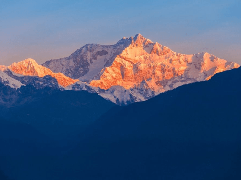
The name is usually translated as the five treasures of the great snow, after the mountain’s five summits. Joe Brown and George Band made the first ascent on 25 May 1955. They stopped just short of the top out of respect for the people of Sikkim, who hold the summit sacred. That respect is still part of the trek.
The route also passes through Limbu, Rai, Sherpa and Tibetan Buddhist communities. You cross suspension bridges, walk past mani walls and sleep in family run lodges. The area is protected as the Kanchenjunga Conservation Area, about 2,035 square kilometres of forest, pasture and glacier. You can read more on the Kanchenjunga Conservation Area website.
Where Does the Kanchenjunga Circuit Go?
The circuit is really two treks joined together. You walk north up the Ghunsa valley to Pangpema, return down the valley, cross a chain of high passes, visit the south side at Oktang, and then walk out to the east.
The north side: Sekathum to Pangpema
From the trailhead near Chirwa and Sekathum you follow the Tamor and Ghunsa rivers through forest and terraced farmland. Amjilosa, Gyabla and Phale lead to Ghunsa, the biggest village in the valley and a good place to rest. Above it come Kambachen and Lhonak, where the landscape turns to moraine and ice. Pangpema, the north base camp at 5,143 m, sits below the huge north face of Kanchenjunga.
The crossing from Ghunsa to Cheram
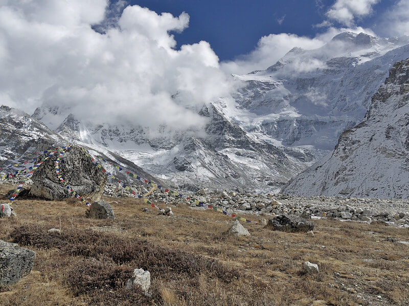
This is the hardest stretch. From Ghunsa you climb to Sele La, then cross a series of passes, including Sinion La and Mirgin La, before dropping to Cheram. Sources put the passes between about 4,400 and 4,650 m, and they differ by a few hundred metres, so treat any single figure with care. Our itinerary gives this crossing a full day of 7 to 8 hours. Clear weather and an early start matter.
The south side: Cheram, Ramche and Oktang
From Cheram you walk up the Yalung Glacier valley to Ramche, at about 4,580 m, the gateway to the south base camp. The Oktang viewpoint, at about 4,730 m, shows the south and southwest faces of Kanchenjunga. Then you descend through Torongding, Yamphudin (also called Sherpa Gaun), Khebang and Happukhola, drive back to Ilam and fly out of Bhadrapur.
Kanchenjunga Circuit Trek Itinerary (24 Days)
This is the plan on our Kanchenjunga Circuit Trek page. Altitudes are the ones we list, and other sources can differ by 100 to 200 metres. Times are approximate.
| Day | Route | Sleep altitude | Time |
|---|---|---|---|
| 1 | Arrive in Kathmandu | 1,360 m | Rest day |
| 2 | Kathmandu sightseeing | 1,360 m | 5 to 6 hours |
| 3 | Fly to Bhadrapur, drive to Ilam | 1,627 m | 45 min flight, 4 to 5 hours drive |
| 4 | Drive to Taplejung | 1,820 m | 5 hours drive |
| 5 | Drive to Chirwa, trek to Sekathum | 1,585 m | 3 to 4 hours drive, 5 to 6 hours walk |
| 6 | Sekathum to Amjilosa | 2,510 m | 5 to 6 hours |
| 7 | Amjilosa to Gyabla | 2,730 m | 6 to 7 hours |
| 8 | Gyabla to Ghunsa | 3,595 m | 6 to 7 hours |
| 9 | Acclimatisation day at Ghunsa | 3,595 m | Short walks |
| 10 | Ghunsa to Kambachen | 4,050 m | 5 to 6 hours |
| 11 | Side trip to Jannu Himal Base Camp, return to Kambachen | 4,050 m (side trip to 4,500 m) | 7 hours |
| 12 | Kambachen to Lhonak | 4,785 m | 5 hours |
| 13 | Lhonak to Pangpema and back | 4,785 m (high point 5,143 m) | 8 hours |
| 14 | Lhonak to Ghunsa | 3,595 m | 7 hours |
| 15 | Ghunsa to Sele La base camp | 4,200 m | 4 to 5 hours |
| 16 | Sele La to Cheram over three passes | 3,870 m | 7 to 8 hours |
| 17 | Cheram to Ramche and Oktang viewpoint, back to Cheram | 3,870 m (Oktang about 4,730 m) | 7 to 8 hours |
| 18 | Cheram to Torongding | 2,080 m | 5 to 6 hours |
| 19 | Torongding to Yamphudin (Sherpa Gaun) | 2,200 m | 6 to 7 hours |
| 20 | Yamphudin to Khebang | 1,910 m | 5 hours |
| 21 | Khebang to Happukhola | 1,050 m | 5 hours |
| 22 | Drive to Ilam | 1,627 m | 4 hours |
| 23 | Drive to Bhadrapur, fly to Kathmandu | 1,360 m | About 3 hours drive, 45 min flight |
Shorter options exist. Our Short Kanchenjunga Circuit Trek runs 18 days, and the Kanchenjunga Base Camp Trek is another route to consider if you have less time. Spare days matter more here than on busier trails, because weather can delay flights and roads.
How Hard Is the Kanchenjunga Circuit Trek?
It is strenuous, and most guides agree it is harder than Everest Base Camp. The trail is not technical, and no climbing skills are needed. The difficulty comes from stacking several things together: long days of 5 to 8 hours, many days above 3,500 m, high passes, steep climbs and descents, and remote terrain with few villages and little rescue support. Snow on the passes can make crampons or microspikes useful.
- Altitude and acclimatisation
Altitude is the main risk. On Day 8 you climb more than 800 m to Ghunsa. A common rule of thumb above 3,000 m is to add no more than about 500 m to your sleeping height each day. Our plan builds in rest days at Ghunsa and Kambachen for that reason. Headache, nausea and poor sleep are common. If symptoms get worse, you must go down. Our first aid kit includes an oximeter.
- Remoteness and weather
Above Ghunsa there are only a few small lodges, phone signal is rare and a helicopter needs good weather to reach you. Landslides can affect the lower trail, especially after rain. This is why insurance, spare days and a guide who knows the valley are not optional extras.
- Fitness and training
Start training two to three months ahead. Walk uphill with a loaded daypack, add long weekend hikes and build leg strength. A previous trek above 4,000 m is a good sign you are ready. If this would be your first Himalayan trek, talk to us before booking, because Kanchenjunga is rarely the best first choice.
Best Time to Trek Kanchenjunga
| Season | Months | What to expect |
|---|---|---|
| Spring | March to May. April and May are best | Blooming rhododendrons in the lower forest, milder nights, some afternoon haze |
| Autumn | Late September to November. October and November are best | Dry, stable weather and the clearest mountain views |
| Monsoon | June to early September | Heavy rain, leeches, landslides and cloud. Not recommended |
| Winter | December to February | Cold, with snow on the passes. Some high lodges may close. Not recommended for the full circuit |
Festival dates change every year. Dashain 2027 falls around 9 to 10 October, and Tihar follows in late October or early November, so confirm the exact dates. Flights and buses fill up around both festivals, so book early if your trek overlaps them. For wider planning, read our guide to the best time for trekking in Nepal and our weather and climate page.
Kanchenjunga Permits and Rules for 2027
| Permit | Cost for foreign nationals | Notes |
|---|---|---|
| Kanchenjunga Restricted Area Permit | USD 20 per person per week for the first four weeks, then USD 25 per week | Issued by the Department of Immigration through a registered agency |
| Kanchenjunga Conservation Area Permit | About NPR 2,000 (roughly USD 15) | Some sources list NPR 3,000, so confirm the current fee before you book |
The biggest rule change is recent. On 22 March 2026, the Department of Immigration removed the old minimum of two trekkers for restricted area permits, so solo trekkers can now apply. The permit must still be requested by a registered agency, a licensed guide is still compulsory, and one guide can lead a maximum of seven trekkers. You cannot get the restricted area permit on your own.
Not sure how this applies to your group size or dates? Message our team and we will explain it. The permits and park fees are included in the price on our tour page.
How Much Does the Kanchenjunga Circuit Trek Cost in 2027?
Operator prices for the full circuit run from about USD 1,850 to USD 3,500 per person, depending on length, group size and what is included. That is a market estimate, not our price. Our 24 day Kanchenjunga Circuit Trek is listed from USD 2,300 per person. The listing includes a guide, a porter for every two trekkers, flights between Kathmandu and Bhadrapur, ground transport, meals on the trek, lodging, permits and park fees. Visa, insurance, drinks and tips are extra. Prices vary with season, group size and exchange rate.
Cost follows difficulty here. Remote logistics and the extra acclimatisation days push the price above shorter treks. For a line by line breakdown, see our Kanchenjunga Circuit Trek cost for 2027 post.
Getting to the Kanchenjunga Trailhead
Fly from Kathmandu to Bhadrapur, about 45 minutes, with Buddha Air or Yeti Airlines. Then drive through the Ilam tea gardens to Taplejung. Our itinerary spreads the road journey over two days: Bhadrapur to Ilam in 4 to 5 hours, then Ilam to Taplejung in about 5 hours, followed by a drive to Chirwa. Flights to the Taplejung airstrip at Suketar exist, but they can be infrequent and are easily cancelled, so plan around Bhadrapur. Roads in this region keep changing, so your guide will confirm the exact starting point before you travel.
Teahouses, Food and Water on the Trail
Lower down, teahouses are simple but comfortable. Above Ghunsa, expect small, basic lodges with cold rooms, a stove only in the dining room and menus that shrink with altitude. Our price includes three meals a day and standard teahouse stays. Nights at 4,500 m are very cold, and our price includes the loan of a sleeping bag and down jacket, to be returned after the trip. Charging, hot showers and WiFi cost extra where they exist. Drink boiled or treated water. See our packing list for trekking in Nepal for the rest of your kit.
Guide, Porter, Insurance and Visa
- Guide and porter
A licensed guide is compulsory in this restricted area. Our price includes a government licensed guide and one porter for every two trekkers. Read more on our page about hiring a guide and porter.
- Travel insurance
Buy insurance that covers trekking to at least 5,500 m and emergency helicopter evacuation. Rescue costs in remote areas can reach thousands of dollars. Our page on travel insurance for trekking in Nepal explains what to look for.
- Nepal visa
Most visitors need a tourist visa. Current fees are USD 30 for 15 days, USD 50 for 30 days and USD 125 for 90 days, so a 30 day visa fits the 24 day plan. Check our Nepal visa information page before you travel.
Kanchenjunga Circuit or Manaslu Circuit?
If you want big mountains and fewer people but have less time, Manaslu is shorter and crosses Larkya La at 5,106 m in about two weeks. Kanchenjunga is longer, quieter and remoter, and it asks for more fitness and more patience. Read our Manaslu Circuit Trek 2027 post to compare the two.
Ready to Trek?
Kanchenjunga rewards patience. It asks for time, fitness and a flexible mind, and it gives back silence, huge views and a trail that still feels wild. If you are thinking about 2027, spring and autumn dates are the ones to plan around. Our 24 day Kanchenjunga Circuit Trek covers the full circuit, and our team can adjust dates, group size and pace. Contact Nepal Mountain Adventure with your dates and trekking background, and we will give you an honest answer on whether it suits you.

Frequently Asked Questions
How long is the Kanchenjunga circuit trek?
The full circuit takes 21 to 26 days. Our itinerary runs 24 days from Kathmandu to Kathmandu, including arrival, drives, flights and rest days.
How hard is the Kanchenjunga circuit trek?
It is strenuous. The trail is not technical, but the length, the altitude, the high passes and the remote terrain make it one of the toughest teahouse treks in Nepal.
How much does the Kanchenjunga circuit trek cost?
Market prices run from about USD 1,850 to USD 3,500 per person. Our 24 day trek is listed from USD 2,300 and includes permits, flights, guide, porter and meals on the trail.
When is the best time to do the Kanchenjunga circuit trek?
October and November, and April and May. Avoid the monsoon from June to early September, and expect snow on the passes from December to February.
Do you need a permit for the Kanchenjunga trek?
Yes. You need a Kanchenjunga Restricted Area Permit and a Kanchenjunga Conservation Area Permit. A registered agency applies for the restricted area permit on your behalf.
Can you trek the Kanchenjunga circuit solo?
Since 22 March 2026 a single trekker can get the restricted area permit, but only through a registered agency and with a licensed guide. Trekking without a guide is not allowed.
Do you need a guide for the Kanchenjunga trek?
Yes. A licensed guide is compulsory in this restricted area. One guide can lead up to seven trekkers.
How high is Kanchenjunga Base Camp?
The north base camp at Pangpema is at 5,143 m. The south side is usually visited at the Oktang viewpoint, about 4,730 m. The mountain itself is 8,586 m.
What is the difference between Kanchenjunga north and south base camp?
The north side is higher, remoter and has huge glacier scenery. The south side is lower and shorter, with views of the south face and the Yalung Glacier. The full circuit visits both.
Is the Kanchenjunga trek teahouse or camping?
Our itinerary uses teahouses. Some high lodges are small, seasonal and very basic, so your guide may adjust the plan to suit the season.
Is there altitude sickness on the Kanchenjunga trek?
It is a real risk. You spend many days above 3,500 m. Rest days at Ghunsa and Kambachen help, and anyone whose symptoms worsen must descend.
Is there WiFi or phone signal on the Kanchenjunga trek?
Signal is patchy in the villages and rare above Ghunsa. WiFi and charging cost extra where they exist, so bring a power bank.
Can you trek Kanchenjunga in winter?
Lower sections are possible, but snow can block the passes and Pangpema, and some high lodges may close. We do not recommend the full circuit from December to February.
Is Kanchenjunga harder than Everest Base Camp?
Yes. It is longer, remote and has fewer services. If Everest Base Camp felt comfortable, Kanchenjunga is a natural next step.
How do you get to the Kanchenjunga trek starting point?
Fly from Kathmandu to Bhadrapur, then drive via Ilam to Taplejung and on to the trailhead near Chirwa and Sekathum.
Do I need travel insurance for the Kanchenjunga trek?
Yes. Choose a policy that covers trekking to at least 5,500 m and helicopter evacuation, because this region is remote and rescue can be costly.


